
So high the water was risin’ our men sinkin’ down
Man, the water was risin’ at places all around,
boy, they’s all around
It was fifty men and children come to sink and drown
A great many blues musicians sang about high water and an old professor of mine once told me there are three things you can do with it:
1- store it 2-convey it to the sea 3- let it flood

Olifants River in Flood. Source: Flickr. Author “Albrigi”
Simple enough. For years, we’ve mostly managed high waters through options 1 and 2, ignoring 3, with concrete and earthen dams and levees to keep the water away. Championed by engineers like Humphreys on the Mississippi in the mid 1850s, advanced engineering and technologies have “tamed the river,” reducing the frequency of smaller floods (as well as our memories of them) and allowed for more economically productive uses of floodplains. As a result, communities have thrived for centuries on low-lands thanks to deepened channels which allowed for navigation and trade, flat fertile soil for agriculture, residential and commercial development, and beautiful waterways as a scenic place to recreate.

FISK Map 1944, Historical Courses of the Mississippi River.
Over time, this way of management restricted the ability of a river to maintain it’s preference–option 3 above: to spread out on to a floodplain every once in a while when waters are greater than the channel capacity.
The Delta Blues remind us that such is the desired course of rivers where floodwaters use the floodplain– irrespective of human settlement on it. Consider also the numerous historical courses of the Mississippi River.
Mark Twain also understood this well.
“The Mississippi River will always have its own way; no engineering skill can persuade it to do otherwise…”
As did William Hammond Hall,
“It should be fully understood then, that floods will occasionally come which must be allowed to spread.”
Giving room in the past
Humans know that we have repurposed floodplains and placed valuable assets in a rivers’ path. We are no stranger to the fact that rivers need room in order to protect our cities, farms, industry, and way of life. We remember the Great Floods of 1927 and the multiple breaches on the Missouri and Mississippi systems during 2011.

1927 Mississippi Flood, Hamburg Louisiana. Source: American Environmental Photographs Collection, Department of Special Collections, University of Chicago Library/File
As early as 1918 in the Sacramento Valley, and in 1928 on the Mississippi River (after 700,000 were displaced), Americans sought to make space for the river. Evacuating of 250,000 Netherlanders in the Rhine basin in 1995 inspired the Dutch to create a national program to let water back into a landscape they had spent centuries keeping dry. Most recently in the San Joaquin Valley after 1997, farmers, engineers, hydrologists, and politicians acknowledged that traditional storage and conveyance alternatives were not alone enough and started discussing a plan. (See: Yolo Bypass, Mississippi River & Trib, Room for the River, and Lower San Joaquin Bypass referenced in 1998 Preface to Kelley’s Battling the Inland Sea.)
Giving room today
Making room for rivers was just the subject of a recent Scientific American article, as well as one in the Economist. Expanding floodways made a grand entrance to the first draft of California’s Central Valley Flood Protection Plan (table 3-2) as a viable way to meet multiple objective, and to a lesser extent, “Room for Rivers” is also considered in the 5th draft of the Delta Plan. Lastly, in 2008, California Legislation from SB 5 (California Water Code Sec 9163 (c) ) required the state consider the feasibility of a bypass on the Lower San Joaquin.
While the concept and buzz word of “Room for Rivers” might be understood by some, what follows is a brief explanation for those who aren’t quite so hydraulically inclined (great blog by the way), and some detail for those who want to know the practicalities.
- What does “room for rivers” mean?
- How do you give a river room? (and where is it appropriate to do so?)
- What are the benefits?
- Example Projects
- Challenges?
- Areas of further research
The explanations and project examples below demonstrate that giving room to rivers actually incorporates all three options above–storing high water, conveying high water, and allowing high water to overflow the banks from time to time.
Presented factually, this post does not advocate for or argue against certain projects– the attempt is to provide information and opportunity for a discussion. There are some additional resources provided at the bottom and please comment if you have questions.
What is it?
Giving Room to Rivers usually refers to allowing higher waters to spread out onto a rivers’ floodplain. In Rising Tide, John Barry describes what is effectively the opposite of “Room for rivers” –a channel confined by dikes and levees.
“…With both banks leveed, the river could not spread out. Therefore, it rose up. Thus the levees, by holding the water in, forced the river higher. In turn, men tried to contain the flood height by building levees still higher.”
-Rising Tide, John Barry

Figure 1. Schematic of giving room to rivers. Left: river between levees (higher water level). Right: river without levees (lower water level). Image created by author, but adapted from Phil Williams and Associates
How do you give room to a river?

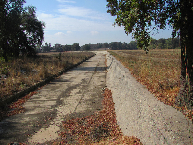
Sacramento Deep Water Shipping Channel. Photo: Adrian Mendoza
In many places, we’ve already altered the natural course and flow regime of rivers for navigation, economic, agricultural, and residential development, hydropower, and flood protection. In California, for example, the hydraulic mining (gold rush) legacy intended to maximize scour left the landscape with narrow river channels cut off rivers from floodplains between high levees (Mount 1995). How do you give room to a river then in a landscape that’s been altered?
Generally it means by:
- Setting back dikes or levees to allow the river to spread out onto the floodplain

Source: Ruimte voor de Rivier: http://www.ruimtevoorderivier.nl/
- Diverting water away from the main channel (bypass) and urban areas or critical infrastructure, and into less developed lands in a controlled manner. This is done through some type of opening in the levee.
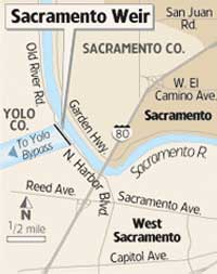
Sacramento weir diverts water off of the main channel (right) toward the Yolo Bypass (left). Credit: Sacramento Bee and Watershed Network

Paradise Weir diverts water off the Lower San Joaquin (up to 18,000cfs) into Paradise Weir in 1998. Image Credit: Mike Archer, MBK.
- Designating overflow areas (often on agricultural land with compensation) to retain flood peaks (high water) until water levels in the main channel drop. This is sometimes called transitory storage.
Where might it be appropriate to give a river room?
In bottlenecks in a system, and also areas upstream of critical infrastructure or dense population centers. Reducing water surface elevations in these areas, or routing water around them all together, reduces the risks from flooding (probability and consequences) in these areas. It is much easier to give rivers room along less developed lands than in developed areas.
What are the benefits?
- Reduce flood risk (improve public safety)
- Restore ecosystem function
- Improve water supply (reliability and flexibility)
- Additional benefits (not discussed or studied in depth) could include: groundwater recharge, water quality improvement, recreational benefit, to name a few
Reduce Flood Risk
1-Reducing water surface elevations (Figure 1 above) reduces the probability of levee failure by overtopping. For example, on a given project, the discharge previously associated with 150-year return period might become a 300-year return period (unpublished study).
2-Reducing water surface elevations reduces the probability of levee failure due to geotechnical failure mechanisms.
3-Reducing water surface elevations reduces the consequences of flooding because damage and loss of life are a function of flood depth .
4-Reducing water surface elevations reduces the consequences of flooding because water on a wider floodplain rise more slowly and this increases warning time. Communities downstream would have time to safely evacuate to higher ground and to move valuables out of harms way. In contrast, in a narrow channel, high waters are confined by levees that can fail suddenly, flooding the land they once protected catastrophically allowing no time for evacuation.
5-Reducing water surface elevations reduces the consequences of flooding because floodways and bypasses can route high, fast moving floodwaters away from urban areas and critical infrastructure and into less developed lands where damage to human life, massive highway, water supply, power, or other infrastructure is not as large a concern. (See MR & T project–Spillways averted disaster in urban areas of Cairo, Baton Rouge, etc.).
6-Designating overflow areas ahead of time (often called transitory storage) again reduces consequences because managers can control the location, timing, depth, and duration of a flood in a specific area (like a prescribed forest fire). Whereas levees left to overtop or fail on their own, often do so in an uncontrolled manner.
Restore Ecosystem Function
Floodplains are some of the most productive ecosystems in the world because they can regulate temperature, filter water, provide more complex habitat and refuge for fish, etc that are not otherwise present in the main channel. They also surpass many purely aquatic and terrestrial ecosystems in primary productivity. Though benefits will vary by species, in general floodways like the Yolo Bypass have proved to be very beneficial to fish, birds, and other aquatic species. One study on the Cosumnes river showed fish raised on the floodplain grew three times as fast as fish that were raised in the river channel below the floodplain.

Fish reared on floodplain grew 3x faster than those reared in main channel. Photo Jeff Opperman Jeffres et al 2008
Floodplain restoration can have important water quality benefits as well including turbidity, sediment, and temperature regulation. See resources at the end for good articles on the benefits of floodplain reconnection.
Improve Water Supply
Giving room to rivers below reservoirs allows for more flexibility in reservoir management which can improve water supply reliability.

Folsom Dam, California. Image Credit: Aquafornia.com
For a simplified explanation, reservoirs in California are managed for two conflicting purposes: Water supply and Flood Control.
A full reservoir is good for water supply because it can store water for use in the drier months. In California’s Mediterrannean climate (wet winters, dry summers), this is key to the state’s agricultural industry as well as the support of larger urban areas.
An empty reservoir, on the other hand, is good for public safety because it has space to capture heavy precipitation events to protect communities downstream of the reservoir from flooding.
If a storm occurs while a reservoir is full, there is no space to capture the precipitation or and reservoir operators will have to release excess water to avoid overtopping the dam. Because many communities are currently downstream of the reservoir, operators cannot safely release water in this situation without significant risk to public safety and property. This is partly what happened in last year along the Souris River in Minot, North Dakota.
Enlarging a floodway below a reservoir allows more water to be released safely without threatening downstream communities. Therefore, enlarging a floodway below a reservoir also allows operators to store more water for the dry season. This concept is also discussed in the Delta Vision Strategic Plan (Strategy 5.2).

Developed by Phil Williams and Associates

Developed by Phil Williams and Associates
Example Projects
Many such projects on multiple scales exist around the world, but I mention just a couple here–with which I am most familiar.
Yolo Bypass
The Yolo Bypass (first proposed by William Hammond Hall), was built by the U.S. Army Corps of Engineers in the early 1900s in order to reduce the frequent flooding in the Sacramento Area. It was component of a greater vision of floodways and bypasses for the Sacramento Valley that was never fully realized.
During high flows when the river gauge is at 33.5 feet (10.2meters), the Yolo Bypass takes water off of the Sacramento River at the Fremont Weir and spills it into a 59,000- acre floodway.

How the Yolo Bypass Works, image courtesy: http://geography.sierra.cc.ca.us/Booth/California/9_water/Yolo_Bypass.jpg
For 80 years, the Yolo Bypass has kept the Sacramento area dry by routing floodwaters around the urban area of Sacramento and into less developed wetland and farmland, where farmers are compensated. The bypass can convey upto 80% of the flows from the Sacramento River, roughly 480,000 cubic feet/ second (13,500 cubic meters/sec), which is equivalent to a flood on the Sacramento with a 1/100 year recurrence interval.
Fremont Weir when dry: Credit: US FWS
Quick video of how Fremont weir works when dry (With John Cain and Steve Rothert of American Rivers)
Followed by one of fremont weir and bypass wet.
The bypass also supports a 16,000 acre (6,500 hectare) wildlife area. It is inundated about every 2-3 years to provide ecological benefit, and studies showed it provides seasonal habitat for at least 40 fish species (including some threatened/listed ones like the Delta Smelt). There has been recent discussion of expanding the bypass.
New Madrid-Bird’s Point Floodway
In May 2011, the midwest experienced extreme flooding and the US Army Corps of Engineers activated three floodways along the Mississippi River in response to high water levels (A plan from 1928 after the first Great Flood).

Flooding at the confluence of Ohio and Mississippi Rivers (2011). Photo: Nasa Earth Observatory
The first floodway, called the Birds’ Point- New Madrid Floodway was to be inundated when water levels reached 61.5 feet (18.7 m) at Cairo, Illinois. The levee would be intentionally breached, diverting flood flows off of the main channel (see figure 2 below) and (back) onto the floodplain. It is estimated to convey 550,000cfs (15,600cms) through the floodway and to reduce flood stage by 7 feet (2.1 meters) at Cairo.
With about 90 landowners in 133,000 acres (53,800 hectares) affected in the region (in red), the decision was somewhat controversial– though in court, the judge defaulted to the original plan from 1928.

Figure 2. Damaged area versus damage prevented from Birds Point New Madrid Floodway. Source: MRC 2011: MR&T Flood Report
Yellow shows the 3,000 people in Cairo, Illinois were protected by the floodway along with some 2.5 Million Acres (1,011,000 hectares) of farm land. Further, personal communication with US Corps of Engineers personnel mentioned farmers within the floodway were compensated financially and some were able to get in a crop of soybeans this year.
“Mr. Wallace and others acknowledge that their worst fears never materialized. “We survived this thing a whole lot better than I thought we would,” he said.”
“There are some areas where it’s going to be hard to get back in and farm it, but not on the scale we feared when this happened,” said Dickie Jordan, the executive director of the local county office for the United States Agriculture Department’s Farm Service Agency.”
For more information: read the Original Plan and history of the Mississippi River and Tributaries Project.
Hondsbroeksche Pleij
The first of 39 “Room for the River” projects on the Dutch river system in the Netherlands was completed in January 2012 near Westervoort (closer to Arnhem). The €30 million project is key in maintaining water distribution at the Rhine River bifurcation (splittingspunt) where the Neder-Rijn (Lower Rhine) takes about 2/3 of the discharge and IJssel River takes about 1/3 during high waters.
Intended to improve public safety, Hondsbroeksche Pleij “reclaimed” 120-hectares of former floodplain on the right bank of the Neder Rijn. At maximum, the project is expected to reduce water surface elevations by 40cm (1.31 feet) though there is some discrepancy (personal communication, unnamed engineers) about the actual reduction given the uncertainty is ±20 cm.
A new setback dike 2.6km long (called the Pleijdike) was constructed roughly 250 m inland to expand channel capacity. Higher water can also be diverted into the recently excavated hoogwatergeul (labeled “bypass”) as a temporary storage area using a 150 meter adjustable weir structure. Bypass here is not as we use it in the US– in this case it represents a high-water storage area.

Hondsbroeksche Pleij pre-project and simulated under average, high, and extreme high water scenarios. Flow direction is from the right to the left. (Image: Dutchwatersector.com/ rijkswaterstaat)
Up to 660 cms (23,300 cfs) can be diverted off of the Rhine during high high waters. The weir has 30 gates and is “manually” adjustable depending how much water they want to divert into the floodplain.

Weir gates at Hondsbroeksche Pleij, first completed Room or River project in the NL. Image Credit: Author, Jessica Ludy
The last component of the project was a seepage channel behind the new dike (because high water can encourage seepage) and a pump to remove the seepage water.

A piece of art constructed to “Beautify the surroundings of the pump.” This is called “water lily with petals” and observer can stand in the center. (Image credit: Author, Jessica Ludy)
For now the project serves mainly public safety and has a nice walking tour around the area. But ecological benefits at Hondsbroeksche Pleij could likely be achieved with more frequent inundation of the floodplain during certain times of the year (depending on which species they hope to benefit). But as of now, the floodplain is expected to be inundated only at extreme high water– about 10 days/year.
The following video (in Dutch) describes the project. It is still worth a look for a nice visual simulation of using the weir to activate the floodplain.
I apologize that the graphics don’t really do this project justice. I’ve struggled to find some which show better how it functions and I’ll post them when I come across.
A few similarities
Common functions: these projects reduce flood risk by giving rivers more space to spread onto floodplains.
Common barriers to implementation: Land acquisition, multiple stakeholders, constrained budgets, construction costs, and infrastructure relocation.
A few differences
Scale: Where as the Dutch project conveys 23,000cfs, the Yolo Bypass has a capacity of 480,000 cfs and the New Madrid 550,000 cfs. See also the City of Napa’s bypass channel through downtown for a smaller-scale example. What this shows though is that these projects can be implemented at multiple scales.
Ecological Benefit: The Yolo Bypass is the only example above with real ecological benefit. (As in, the benefits have been assessed and the project has explicitly a group working on the ecological side of things.) Dutch projects to date add “spatial/scenic quality” as an after thought and I’m not aware how much research (at this moment) goes into ecosystem restoration before hand. Given most of the 39 projects have not yet been built, it is still a possibility to design them with this in mind if ecosystem restoration becomes a true priority.
Political barriers to implementation: A national Dutch effort and interest behind Room for Rivers appears to make Room for Rivers more “feasible” in the Netherlands than in the United States for a few reasons (that each deserve their own article).
1- It could be related to the 1% of Dutch GDP that goes toward managing water compared to…(I don’t know the figure in the United States).
2-Further, the Dutch have a national interest in keeping their feet dry because so much of the country is flood prone. In the United States, flooding is largely a local/geographical issue (despite that paying for flood damages becomes national), and as such, it has can be more difficult to muster the financial and political support for certain types of projects given many of the taxpayers won’t’ see the immediate benefits.
Public Awareness and Support: Though the Dutch are not the only ones to give room to rivers, the Dutch government has done an excellent job branding the Room for the River program all over the Netherlands and abroad. Through great visitors centers, television shows, and short videos, the Dutch have educated their public about the benefits of such a program, and simultaneously instilled a sense of pride, understanding, and support for the projects.
Areas for further research
- Specific habitat needs in room for river projects including hydrologic regime (time, depth, duration, temperature, etc).
- Quantifying benefits of room for rivers: ecosystem benefits, recreational, water quality, groundwater recharge, damages averted including loss of life, economic damages, business interruptions
- Possible self-mitigating projects: given constructing levees would require environmental mitigation anyway (in the United States), floodplain restoration in the project could create the ecological benefits needed compensate for the environmental “damage” in the project.
- Expanding capacity could provide more flexibility over the long term for adapting to climate change.
A note about, structural vs. non-structural vs. technical vs “natural” vs…?

The Sacramento Weir is a technical measure which diverts water off of the Sacramento River into the Yolo Bypass, a more “natural” flood defense measure

The Morganza Spillway is a “technical” measure which spills high waters from the Mississippi River off of the main channel and onto it’s more “natural” floodplain, protecting urban areas in New Orleans and Baton Rouge from flooding
Additional Resources
European Union: Wise Use of Floodplains,
European Union: Adaptive Landuse for Flood Alleviation (ALFA)
European Center for River Restoration: The Sustainable Development of Floodplains
Three Rivers Levee Improvement Authority
Barry, John C. (1998) The Great Mississippi Flood of 1927 and How it Changed America
Yolo Bypass
California Department of Water Resources (access 2012). Beneath the Flood.
Bird’s Point-New Madrid Floodway
Mississippi River Commission 2011. MRC_2011_Flood_Report
In Missouri, as Levee Is Rebuilt, Signs of Rebirth Begin to Sprout, New York Times, January 12, 2012
Hondsbroeksche Pleij
Official Project Site of Hondsbroeksche Pleij, http://www.ruimtevoorderivier.nl/hondsbroekschepleij.aspx
Floodplains and Floodways
Jeff Mount, (2011) The Benefits of Floodplain Reconnection.
Jeffres, C., J. Opperman and P. Moyle (2008), “Ephemeral floodplain habitats provide best growth conditions for juvenile Chinook salmon in a California river,” Environmental Biology of Fishes 83 (4): 449-458.
Mount JF (1995) California rivers and streams: the conflict between fluvial process and land use. University of California Press, London
Room for the River/Ruimte voor de Rivier Dutch National Program Website

Pingback: » A Few Good Reads (3/19/12): Murrumbidgee River Flooding Hydraulically Inclined
Pingback: From the Outside Looking In(to the Corps)… | The Water Away